Thursday, May 12, 2016

Today was by far my personal favorite. Our group had the opportunity to work with middle and high school students on a small scale science project that involved the extraction of DNA from cheek cells. DNA is cool and all, but I have to say participating in my first Russian kickball was the most exciting experience of the day. The object of the game was to either catch the ball or tag an individual on the other team before they reach the safe zone until you reach 3 “outs” and can switch from outfield to the infield. I won’t go into detail, but you could say we need a few more practices before we’re at the same level as these kids.
Upon returning to the cabins we made some last-minute touchups to our research projects, took our exam for the term, and finally presented some interesting research that focused on many topics that we’ve touched on since arriving in Alaska. Some of the topics included volcanos, sea stars, bald eagles, and how these huge networks of organismal interaction somehow tie together in a harmonious way.

Tomorrow we are looking forward to a surprise excursion! I’m sure there will be many photographs to come! Seal you tomorrow!

-Leslie Hixon

Wednesday, May 11, 2016

Alaska Sea Life Center – Seward, Alaska

Opened in 1998, in response to the 1989 Exxon Valdez oil spill, the Alaska Sea Life Center is a non-profit organization, which was constructed so that in case of another environmental disaster, there would be a team that was well prepared to respond. Although the center was initially funded for animals effected by the oil spill, it has expanded to house any animal that may have been injured or abandoned in the wild. The rehabilitation center examines, treats, and monitors any type of marine life that may come to the center. Larger mammals, such as: Steller sea lions, harbor seals, and sea otters, as well as some smaller fish and crustaceans are on display. Visitors can observe these animals in large tanks, with glass that extends through two floors.
            Along with the rehabilitation aspect of the center, there are many marine specialists that will do research in the field. The questions posed by scientists can range anywhere from “do seals get cold?” to ways to improve the technology used to record data. The data collected in the field and the observations made at the sea life center can then be used to infer what is happening to animal populations out in the wild and could, potentially, assist scientists in finding solutions to ecological problems. The facility includes many wet and dry labs that allow for many different research teams to work at once. Also, there is a full lab that allows tests to be performed on site.
            The Seal Life Center also serves as an educational opportunity for underprivileged students in the Anchorage area and in rural areas. With the assistance of funding, educational ambassadors can travel to rural places, where there may be students who have never seen the ocean before, and introduce them to marine life. This type of educational outreach benefits the students and the sea life center. Another interesting aspect of the Sea Life Center is that it is completely powered by renewable power. They use the water from their enclosures as a way to heat the entire facility and the side walks. Not only that, but they also are so efficient that they are working with the town of Seward to try and have the town also be powered by the renewable source.

            We were allowed access to the behind the scenes functions of the center. The tour took us to food prep area and then to the rehabilitation tanks, which serve as an area to keep injured animals isolated from the other animals. From the rehabilitation tanks, we then traveled to the outdoor enclosures, which contained ice seals and otters. These animals were either recently brought to the center, or they were not ready to be introduced into the show tanks yet. As we moved through the hallways, there were visual presentations of the research teams’ projects. Our tour ended with a visit to the power source for the building, which turned out to be only a small blue box. 


Seavey’s Iditarod

Dan Seavey Sr. brought his family to Alaska in the year of 1963. Dan Sr. had the hopes of mushing and bringing his family into the mushing lifestyle. In 1971 Dan Sr. and some colleagues joined forces and began to create what would become the Iditarod Trail Sled Dog Race. Dan took the trail for the first time with 11 dogs and 36 other mushers. In 2012, Dan placed 50th at the age of 74. Dan’s son Mitch competed in his first Iditarod in 1982 and has competed in every Iditarod ever since 1995. In the past 21 years Mitch has won twice in 2004 and 2013 and has placed in second place since 2013. Mitch’s son Dallas has become the youngest Iditarod Champion at the age of 25 in 2012. He also was the youngest ever musher starting right at the age of 18. Dallas’ first win was in the year of 2011 and he has won the 2014 Iditarod as well as continued to defend his title ever since. Mitch owns 182 dogs, 16 of which were on his 2016-second place team.

On our trip to Seavey’s, we were able to pet and socialize with all the 182 dogs, were taken on a dog “sled” trail (sled in quotations because there is no snow on the ground), and played with some younger sled dogs. We also learned more about the Iditarod, such as what the mushers wear, and even what the dogs wear while running and resting.
           
Two of the “pups”.                             Robin the model for the dog gear


A quick fun fact about Seavey’s, they bred the dog that was the main character in the infamous dog sled movie Snow Dogs.
 -The type of dog that they use for the movies instead of the typical sled dogs.


Rachael Planishek and Kristin Gilbert


Day 14 – Today we took a three hour trip away from our home base at Anchor Point and headed up to Seward to go whale watching. We checked in with Major Marine Tours at the harbor 360 hotel – where we will be staying tonight. At 11:30 the boat left port and headed out towards the Gulf of Alaska. The first thing we saw was Bear Glacier which is the biggest glacier in America stretching 13 miles long and 1 mile deep. Not too far away, in Pony Cove, we saw our first humpback whale when it surface to blow. In Pony Cove we also saw a group of 3 gray whales. They did not show themselves as much as the humpback whale and they had a shorter blow. As we were leaving the cove the first humpback whale made a second appearance for us. Further along in Aialik Cape we saw 3 Orcas – 2 adults and a baby. The ranger narrating the tour explain that there are two types of Orcas: resident and transient. Resident Orcas eat fish such as salmon, halibut, and cod. Transient Orcas eat mammals such as harbor seals and grey whale calves and they generally life in small groups and travel over large ranges. The animals took a break while we enjoyed a meal. On the cruise we were served rib eye steak and salmon for lunch, along with a side salad, rice, and bread. Dessert was a chocolate chip brownie and cheesecake. After lunch we entered Aialik Bay and traveled to Holgate Glacier. The captain had to navigate an ice field to get close to it. The glacier was covered in snow, but had pieces of bright blue ice visible. The blue color is caused by the ice absorbing other wave lengths of light while blue light was reflected back because of its shorter wavelength. At the glacier we witnessed a piece of it break off and crash into the ocean with a bang. Lounging on top the floating ice we saw seals. In the Northwest Fjord we saw a bald eagle perched on a log on the beach near the glacier. We then proceeded out into Aialik bay to begin the journey back to Seward. In the bay we saw another humpback whale. The whale showed us its back and tail a few times before diving down out of view. Next we saw sea lions sunbathing on a small group of rocks in the Gulf of Alaska. The final animals on our cruise was a small group of horned puffins flying in front of the boat. We arrived back in Seward at 5:30 and had some down time to relax and go shopping. The group split up for dinner with half eating pizza and the other half eating Mexican food. The rest of the night was for lounging around and preparing for our final Tuesday in Alaska.


Elizabeth Dano & Jessica Rynders

Monday, May 9, 2016

Today the rest of the class went deep sea fishing. We drove to Anchor Point Beach, where we then boarded boats and a tractor backed the boats into the bay off of the boat trailers. After finally reaching deep enough water, we were able to start fishing for salmon. The depth of this water was approximately 25 feet. On the smaller boat, Kristi and Rachael caught the only two salmon. Paige managed to catch a few small halibut that had to be released. On the larger boat, the group was able to catch 4 out of the 5 salmons allowed to catch.


We then drove out deeper into the bay where the water was approximately 110 feet deep. Here, the strategy was a little different when catching halibut. The strategy was to let the line bob on the bottom of the bay, since that’s about where the halibut like to be. A few times the fish seemed to snack on the bait without being hooked, so we often had to add new bait to the hooks to try again. As a fun fact, the halibut begin their life looking as a normal fish, but as the more mature they get, the halibut’s eye begins to migrate to the side of their head and their bodies begin to flatten. Dr. Stilts managed to snag the biggest halibut on our fishing trip! Whereas Leslie and Paige managed to catch the smallest ones! Overall it was definitely an experience and we all get to take some salmon and halibut home!

Kristi Welkley and Paige Heintzelman

Sunday, May 8, 2016


Today we took a boat from the Homer Spit to Yukon Island. From there, we got in kayaks and spent 6 hours kayaking around the island with True North Kayak Adventures. Most of our kayaks were tandem, and they were equipped with pedals for the back passenger that connected to a rudder. This helped us to navigate the water. 


We saw lots of marine life while paddling in the more shallow water, including lots of sunflower sea stars. These sea stars are much larger than true stars, and can have up to 24 arms. We had the opportunity to watch one of these sea stars flip itself over. 


While circumnavigating the island we also had the chance to try seaweed. It tasted rather salty. Today was the lowest low tide of the year, which meant we were able to see lots of creatures. 


We passed by a homestead on the island which had been passed down through generations in a particular family. The man who currently owns the property grew up on the island and was homeschooled with his siblings in a small house overlooking the water.

When we reached our halfway mark on the other side of Yukon Island, we stopped at a beach for lunch. Our guides were generous enough to provide us with granola bars and hot chocolate. Here we learned that part of the island was an archaeological site that had been started by an archaeologist named Frederica de Laguna. De Laguna is from Pennsylvania and attended Bryn Mawr College. On the island she discovered a midden (a heap of trash that accumulated when Alaska Natives occupied the island) that was three layers deep. We were also able to climb to the top of a steep hill on the island, where we were careful not to touch any of the push key we passed. At the top of this hill we had a great view of the bay and stood by a burial ground where two caskets containing 62 corpses had been discovered.


After returning to Anchor Point, we prepared an Italian meal and surprise desserts for Paige because today is her birthday. After dinner we gave Paige a birthday card from all of us and enjoyed pudding and chocolate cake.


Junko Natsume and Brianna Buckley

Saturday, May 7, 2016

Bright and early this morning the group visited the Russian Orthodox Church in Kasilof. The church was a beautiful white and green church overlooking the bay. The church is still actively used and has a graveyard enclosed within the church’s premises. The Russian’s moved to Alaskan territories in the 1800’s. They were seeking money in commercial trapping and selling the fur. During this, they enslaved the natives of the Alaskan territories for this purpose. Eventually, the places that were taken over by the Russians were taken back over by the natives of the land due to an uproar of being enslaved. There are few Russian territories in this region now, and the territories that are left have working churches such as this one.


Our next stop was the Kasilof Regional Historical Association Museum in Kasilof. Here they had several of the original cabins built by the first settlers in the Kasilof area. The rise in many homesteads being built in this area was due to the cannery business. The fishermen would catch the fish and would sell the fish to the canneries. Another reason for moving to this area was for trophy hunting. Hunters would shoot and kill trophy moose, along with animals that had valuable furs and pelts. Many of these cabins were small, but were sufficient enough for the families. All of the original cabins had original artifacts used during these times. Some items include old milk jugs, dining utensils, fire stoves, fishing supplies, boats, and replicas of their foods. They also had ancient artifacts they found in earlier eras, such as mammal teeth and bones. These cabins were owned by small families that were the first settlers in these areas.


Our third stop was at the Soldotna Homestead Museum in Soldotna. At this museum, were some of the first cabins built from the veterans of WWII. This was part of the Homestead Act which ended in 1989. Part of this Homestead Act stated that any veteran of the war could own 40-160 acres of land, as long as they built a livable dwelling with two windows and a door, and lived there for 7 months in one consecutive year. If a person wanting to own land but was not a veteran, they had to live there at least 9 months of the year for 5 years. These landowners were often into commercial hunting. They would sell these animals to make a living. Often, these people did not have much, as majority of them were veterans of the war. If the property line goes up to a river, the landowner cannot own the land on the other side of the river, even if they did not get all the acres they were promised. Some of the artifacts found in these were small kitchenettes, one mirror, small beds, and few personal items. There was one schoolhouse, which taught kids in grades kindergarten through 7th grade. Many kids dropped out of school due to helping their families with the homestead.


Our fourth and final stop was to the Kenai Visitor Center and Museum. In the museum, there were artifacts dated back to the natives. They had different outfits used for events, such as dancing and rituals. They had artifacts from the several native tribes in Alaska, dating back to the early 1700’s.  Some of these artifacts included trading items, furs, utensils, and household items. During this stop, we went on a walk around the old Kenai Village. We saw the first chapel built in this region. An interesting fact about this chapel was that the door is so short to enter the chapel, that it made people bow down, which symbolizes bowing down for their God. The first Pastor and two followers of this chapel were buried beneath it. We also saw another Russian Orthodox Church while on this walk. It is still actively used, and the Priest’s house is across from it, and it is his duty to watch over the church. As a fun fact, the tour guide told us everyone in this church stands during the service. It is a tale that is told that God believes men daydream while sitting, and women gossip while sitting. The next stop on this walk was the first settler’s cabins that were built in the area. Most were very small, to help conserve heat. Some of the cabins held up to 14 family members. Sometimes in the local convenient stores, it would take almost a month to have items shipped in. Some items found in the houses were medicines and basic household items that were sometimes sold in a local convenient store. As a fun fact, the basement of the local convenient store during these times were used as a morgue during the winter times.


Paige Heintzelman and Kristi Welkley

Friday, May 6, 2016

Today was dedicated to giving back a little to the Alaskan community. A majority of our morning and afternoon was spent working with Moore’s Landscaping on a restoration project located on the Kenai River. The main purpose of this project was to better the river’s condition by fighting against erosion created by boat traffic. However, secondary benefits such as new habitat for juvenile/small fish species were created as well as better suited locations for recreational fishing. The project itself involved creating a bed of dead spruce branches, digging a small trench along its edge, inserting “logs” followed by willow twigs, and finally sealing the twigs in with a thick layer of dirt. This project is expected to last up to 30 years with regular maintenance and will play a role is preserving the wildlife seen in the beautiful rivers of Alaska.


Worry not, the day was not all sweat and tears! We were graciously treated with pizza and cookies by the workers of Moore’s Landscaping before returning to the cabins and learning some general information about climate and the characteristics of each biome type.
Dr. Smith briefly spoke about many factors influencing climate including the earth’s energy balance, effects of plant life, tilt of the earths’ axis, and the general movement of air based on temperature. We then spoke in depth of the characteristics of each biome type. There are 9 biome types in total which are classified by plant life, temperature, and precipitation.

Tundra
·       Temperature: Below freezing most of the year
·       Precipitation: Low overall, slightly higher in the summer
·       Vegetation: Small plants rather than trees

Boreal Forest/Taiga
·       Temperature: Below freezing most of the year
·       Precipitation: Low to medium, higher in summer
·       Vegetation: Mostly evergreen, fires are common

Temperate coniferous forest
·       Temperature: distinct season
·       Precipitation: medium overall, highly variable, higher in summer
·       Vegetation: mostly evergreen trees, fire are common

Temperate deciduous forest
·       Temperature: distinct season
·       Precipitation: medium overall, slightly higher in summer
·       Vegetation: mostly deciduous trees, losing leaves saves energy in winter

Temperate scrubland
·       Temperature: distinct season
·       Precipitation: medium overall, higher in winter
·       Vegetation: shrubs that survive hot dry summer, evergreen

Temperate grassland
·       Temperature: distinct season
·       Precipitation: high in summer, lower in winter than other temperate biome
·       Vegetation: few trees or shrubs grasses

Tropical Rainforest
·       Temperature : high year around
·       Precipitation: high overall, may vary or be constantly high
·       Vegetation: mix of trees, often varies height

Tropical seasonal forest
·       Temperature : High around year
·       Precipitation: wet and dry season
·       Vegetation: varies widely- forest, scrublands, savannas

Desert
·       Temperature: distinct season, but rarely below freezing
·       Precipitation: low overall

·       Vegetation: small, spark plants, often succulent 


   Leslie Hixon and Chandra Chamalagai

Wednesday, May 4, 2016

May 4th, 2016: Day 9
Today we went to the Wynn Nature Center, Islands and Oceans, and the Pratt Museum.
We reviewed some topics and learned about others! Topics we reviewed included the four types of spruce, especially the Lutz Spruce, the Spruce Bark Beetle, lichens, Pushkee (cow parsnip), and the Willow's role in a common Alaskan moose diet.

Topics that were new included the purpose of Animal Corridors, varying flora and fauna, and Alaskan history. Animal corridors are paths that multiple species utilize for food and water sources, regardless of their position in the food chain. Willow roses are structures in which nymphs lay eggs in the willow. The wasps in the area are aware of this process and consequently lay their eggs within the nymph. The nymph then serves as a food source for the developing wasp eggs. The birds we learned about were the white-eyed Junco, Stellar Jay, and Wilson's Snipe. We were introduced to these birds' calls and appearances. We learned that Black Spruce trees prefer acidic soil and that Alder trees are flexible. This flexibility makes them stronger against soil disturbances and thus an important tree in mountainside environments that are prone to avalanches. Spruces frequently grow out of other fallen spruces, called "nursery logs," and provide food sources to many animals in the forest community. Snowshoe hares eat the spruce needles, squirrels eat the cones, and many other woodland creatures eat the bark. Although the moose do not typically eat the spruce, they do eat the willow during the winter months. This causes their scat to essentially be pelleted sawdust during January and February. This period of willow eating also serves as a beneficial pruning to the willows.

As a review, Alaska officially gained statehood in 1959. Due to this later time, it's Homestead Act ended in 1989, or the same year as the Exxon oil spill in Prince William Sound, Alaska. The Homestead Act (reminder of everyone's US History class) encouraged individuals to come to an area of land and maintain 140 acres of land. The land was free if maintained for five years with a settlement on it. This encouraged many people in post-WWII to venture up to Alaska. Who wouldn't want to with these gorgeous views?! (and cold winters, harsh growing seasons, and unpredictable seasons)


At the second location, we learned that Spruce Aphids are another source of mortality in spruce. Unlike the beetles, the aphids destroy the spruce through the needles (captured below, top). Near the estuary, we encountered many new species of organisms. Yaro, a common grass-like plant, serves as a natural blood coagulant. Within the estuary, the bacteria, if properly functioning, produced an oily substance that floated atop the water. There were high concentrations of iron in the water which caused the water to have a ruddy-brown tone (captured below, bottom).


At the third location, the Pratt Museum, the class learned about Alaskan history and animal life. The Native groups to the Kachemak Bay region are the Alutiq and Dena'ina, which are also two of the four languages spoken in the area, with English and Russian being the others. Tools that were used by the indigenous people to hunt, especially in hunting seals for their nutrient rich blubber, included the quiver, the seal spear, and the throwing board.

Also at the Pratt Museum we were introduced to the severity of the 1989 Exxon Valdez oil spill that harmed the ecosystems and economies of Americans everywhere. Duh duh duhhhhhhhhhhhhhhhhhhhhhhHHHHHHHHHHHHHH. The oil spill was caused by the Exxon Valdez ship wrecking onto the coast of the Prince William Sound bay, 25 miles south of Bligh Reef, causing 11 million gallons of oil to pour out of the ship. Clean up crews responded slowly and no one wanted to take responsibility to restore the waters, causing only 4% of the spill to have been cleaned after multiple weeks. Decades later, approximately 20 acres of land are still directly impacted by the spill and 58% of the 91 original sites still have oil present. Captain Hazelwood, who was in charge of the ship when the wreck occurred, was found guilty of drunk driving soon after the spill, although he appealed the case. Exxon never truly took responsibility for the mishap. While the event was extremely unfortunate, it prepared the world for other oil spills and how to best approach them.

Thanks a bunch for coming along on our exciting and splendiferous journey.
This is Katie and Mallori, signing out. TTFN <3

Tuesday, May 3, 2016

Alaska Day 8

Today we drove onto the Homer spit and took a boat ride over to the Kachemak Bay State Park. At the park we started off with a short walk along then beach, then headed into the Alaskan forests to embark on a 6 mile hike. Along the way we came across a hand tram. In order to cross a river and eat lunch we had to use the hand tram. It was a basket big enough for three people that was attached to a rope that you pulled in order to cross the river. It was strenuous on the arms to pull the tram across the river and back, but the view on the ride and at the lunch spot was well worth the effort. Once our bellies were full and our arms were tired we continued to hike on towards a glacier. The walk to the glacier was tiring and rocky, but when we got there the view of the glacier took our breath away. We learned that the surrounding vegetation was growing at unequal rates because there was an avalanche that caused the bay to rush over the vegetation - killing it. We ended our adventure at Kachemak Bay State Park by hiking over a mountain to reach the beach below. At the beach we met up with a Taxi boat to take us back to Homer. On the boat we met a cute black lab named Selkie. The puppy slept on Dr. Stilts the entire ride back. Once we arrived safely back in Homer we spent a half an hour shopping then headed to Save-You-More to stock up on groceries. We ended the day relaxing around the cabin.


Elizabeth Dano and Jessica Rynders


Day 5: Impromptu Free Day!
The water was a little too rough today for half of our group to go deep-sea fishing. So, for our impromptu free-day, we had a couple of rounds of trips to The Homer Spit, a quaint boating and fishing village with the cutest little shops. The small group that we were with stopped into Captain Patties for a quick bite to eat. Upon looking at the menu, we determined that it was a little classier than we were prepared for and just ordered a couple of appetizers… which were delicious. The view wasn’t too bad either:


Abby W. and Katie G.

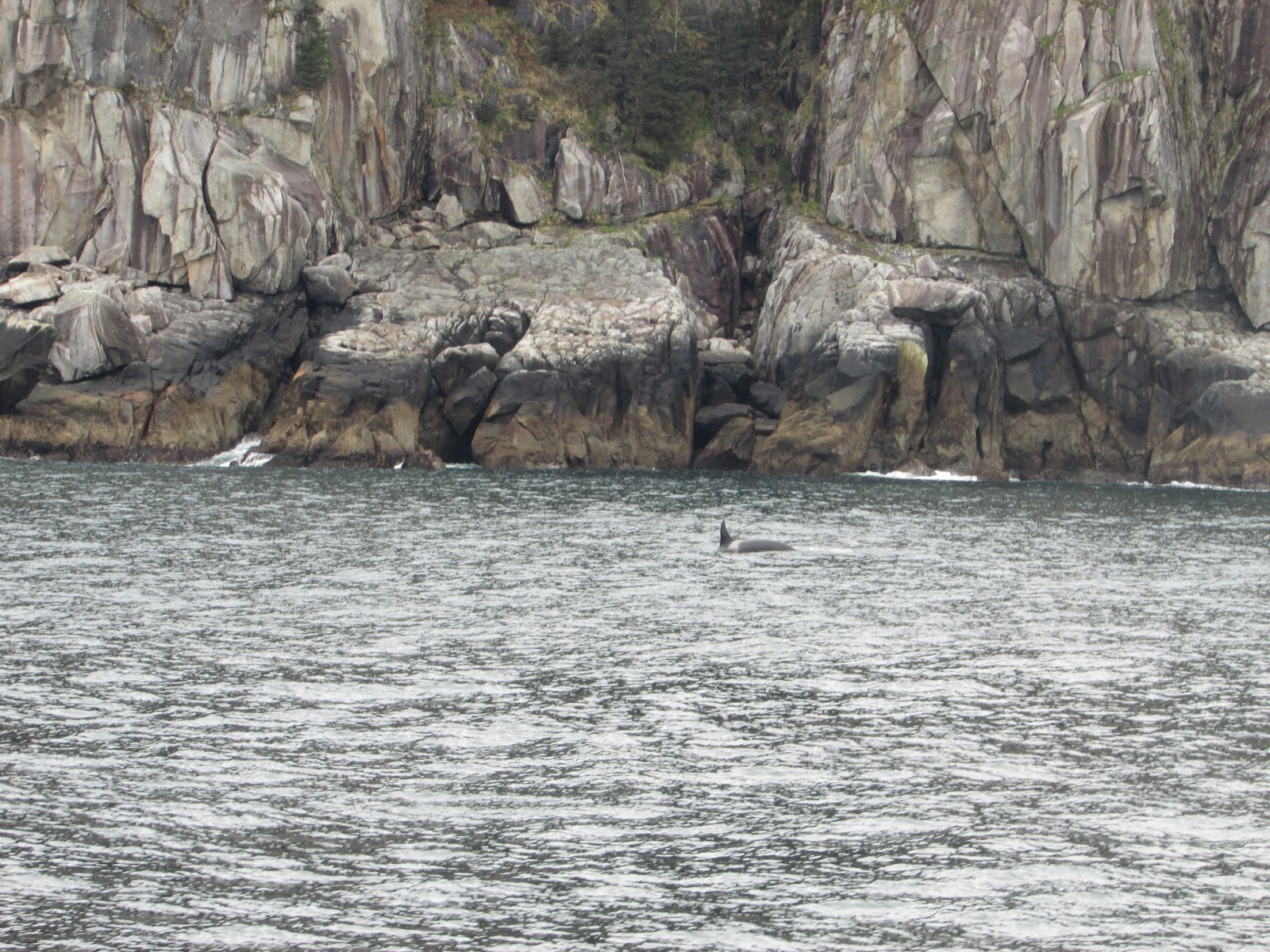
Day 6: Gone Fishing!
Today the waters in Cook Inlet cooperated enough to get eight members of the group into a couple of boats and head out to do some deep sea fishing. Our group was led out by a couple of local fishermen to a few spots they were sure we could catch some descent sized salmon and halibut. The ride out was a little frigid, so luckily there was plenty of room in the cabin to keep warm. After a short ride out, we found a spot and started fishing.


Deep sea fishing was different than either of us had experienced. Rather than holding onto and casting the pole as is done with fresh water fishing (which we had both done plenty of times before), the pole was set into a holder and the bait, green herring in this case, was cast down into the water using a submerging device. After the herring was submerged, we sat (or stood) and waited, watching the pole for a clear jerk or dip. Once this happened we jumped up and grabbed the poles. Reeling in the fish was a smoother, but more difficult process. It seemed to take much more effort and time to reel them in, which makes sense when you see the size of some of these fish!

Unfortunately, we started off catching nothing but these ugly-looking scrawny fish called Pollock; which were no good for eating and just a frustrating waste of time and energy. The trip out to sea also took an unexpected turn as one member of the group was not able to keep their breakfast down, nor really keep lively for the remainder of the expedition. The waters were still pretty rough and motion sickness is no joke, man.
Between the two boats, a total of six king salmon were caught. The water was a little too rough to drop anchor for halibut fishing, though we did end up catching four smaller ones anyways. After going back to shore, we headed out to one of the guide’s homes to watch the guides process the fish. One of them described halibut as “made to fillet” because the main part of their body is split into four easy-to-fillet sections. The cheek of the halibut was also saved and was described the “filet mignon” of the fish because of how tender that region is due to its lack of use. Most of the salmon were red meat, however one had white meat which indicates that it comes from a specific Canadian river. We had one of the salmons filleted on the spot and took it back to the cabins for dinner. The remaining fish we had sent off with a local who will fillet and freeze them for us to take back to New York.
Here are some photos of the fish we each caught and a video of the guides processing our catch:


Day 7
Today was a relaxing day spent mostly on the home base. Throughout the day we had three separate presentations, and what turned into well-deserved snack/badminton/nap breaks between each.
The first of these presentations was given by Brian Carey, the project manager for the Susitna Dam initiative, a representative for the Alaska Energy Authority. Mr. Carey’s presentation was largely the opposite of the one the Susitna River Coalition gave only a few days ago, focusing mainly on the reasons the Susitna Dam should be built. Among these is the fact that controlling the flow of the Susitna would allow for hydroelectric power to be gathered from the river, which would ultimately provide energy for several surrounding villages. While the investment into such projects and obtaining the energy may be at first costly, energy obtained from water-power will “remain at the same price” while other sources of energy, such as fuel, may later spike in price based on demand. During his presentation, Mr. Carey also explored other sources of energy, and other projects, and why they may not work as well as water power in Alaska. Unfortunately, wind power does not yield great energy in Alaska due to large variation in wind speed and occurrence, and the inability of natural conditions to keep the turbine spinning. Solar power, along the same lines, is hindered by the large fluctuations in daylight hours and general comparative weakness of sun rays in Alaska. With that- hydroelectric is cited to be the most efficient means of renewable energy in Alaska, despite the many cons of specific projects which we had already been made aware of. The presentation left many of us questioning our views of a possible lose-lose situation.

The second presentation of the day was given by Corin Ogle, the lovely granddaughter of our very own temporary landlord. Corin gave a rundown of another project currently in the works, the construction of the Pebble Mine. The Pebble Mine site is currently the largest known source of copper and gold, and the second largest we have ever discovered. The waste pits for this mining site, if constructed, would be among the top ten largest human-made structures- eventually holding over ten billion tons of “waste”- i.e. whatever is left behind from long term mining ventures.
Bristol Bay, the proposed site of the Pebble Mine, is known for its pure and undisturbed wildlife. The watershed contains 29 different species of fish, 190 types of birds, and 40 terrestrial mammal species- representing many of these in their purest and most natural form. In this vast area all five species of salmon are represented, and the area serves as spawning sites for 46% of all the world’s wild salmon. This means that every year, 60 million salmon work their way to Bristol Bay to spawn their young! The 31 native villages still operating in the area are relatively self-sustaining due to these immense natural resources.
The sides of this argument are difficult ones, which is why much research has been done on the possible impact of the Pebble Mine. Just recently the Environmental Protection Agency decided that the detriments the mine would pose to the natural life greatly outweigh the 200 billion dollar potential worth of the mining site. For now, however, the issue remains unresolved, as upon hearing the results of the EPA study, the Pebble Partnership essentially sued the discovery, pushing again for permission to build their giant mine. Stay strong Bristol Bay, stay strong.

After a nice longer break, the final presentation of the day provided the group with the special policies and activities necessary to maintain and preserve the Arctic climate which exists in much of Alaska. Our presenter started with the basics of the region, ensuring to us that protection of the Arctic was much more than simply looking out for Santa Clause and his elves. Much of the Alaskan Arctic is owned by Russia, Canada, the United States, Finland, Sweden, Denmark, Iceland and Greenland, all of which have created a taskforce of sorts to preserve the area and make collective decisions about its use. The resulting Arctic Counsel, which also includes six native representatives, compiles information and reports regarding the area, guiding public and foreign policy. The group aims to create “One Arctic” where all stakeholders have the same core goals in mind- and take all specialized needs and resources in the region seriously.
After a long hard day of learning (and snacking) the starving groups went their separate ways to find (more) food. The Stilts crew took a trip to the grocery store, while the Smith clan took a trip to Homer, where we visited the Carribou Family Diner, where many members of the group had their first taste of caribou and bison burgers! On the way to Homer we stopped along a scenic pull-off, and snapped a few family photos. Note the rainbow and majestically Soaring Eagle (This one is for you EC).


Abby W. and Katie G. 

Sunday, May 1, 2016

Day Four: Renewable Energy Sources, Coal Mining, and the Susitna River Dam

We started today with two presentations right in the cabins. The first presentation talked about the cons of the Susitna River Dam on the community, ecosystems, and Alaska in general. The second was on the responsibility of coal in the Alaskan energy demand and the misconceptions around coal mining that do not necessarily extend past the lower 48.
 

Ellen and Doug came all the way from Telkeetna, Alaska to speak on behalf of the Susitna River Coalition whose mission statement is to stop the proposed Susitna mega dam through collaboration, education, advocacy and awareness of the values of an intact Susitna watershed and eventually to establish permanent protection for the river. The Susitna River Coalition started as a group of 5 people in 2012 that through grass root efforts such as booths at the state fair and sports shows was able to grow the organizations numbers to around 5,000 people in 2014 and eventually approximately 20,000 people in 2016. There were many interesting facts that were presented during this talk about the dam and the Susitna River itself. Some of which being that the dam would only allow a third to one forth the original water to flow in the summer months, the dam itself would power one half if urban Alaska and would be located 184 miles up from the mouth of the river past devil’s canyon. The dam would be load-barring meaning that the dam would let water out when energy need is high and conserve water when its low, meaning that the water level of the river would fluctuate between 10-12 feet. The Susitna River itself is a glacier fed river which means that the ecosystem itself depends on ice and the placement of a dam on this river would block the formation of ice that’s needed by the fish and the ecosystem due to the constant movement of water to produce power. Other interesting facts that were presented was the fact the the state of Alaska has spent almost $193 million on research alone on studies about the dam and the expected cost of the dam is approximatively $6 billion that would come from public funds usually allocated to education and public works such as libraries. Another fact that was brought up was the effect that dams have had on the salmon population in the lower 48 and the fact that the placement of the Susitna River Dam would have on the salmon population in Alaska would be detrimental. https://vimeo.com/144622860
 Ellen and Doug from the Susitna River Coalition holding up a picture of the Susitna River and the logo designed by a local artist.


The second presentation of the day was given by Dan and Lorali, on the uses and benefits of Alaskan coal, from the Alaskan Coal Association. They started their presentation with breaking down the Nationwide Energy Balance and the categories of fuels used to produce energy demand.


There is no denying that the landscape of energy use needs to change to more viable options, coal, oil, and gas have a known expiration date. Oil and natural gas is expected to run dry in about 50 years while coal is expected in 100 years. However high the need for renewable energy to replace these old methods, renewable energy goes hand-in-hand with coal and oil. The materials needed to make renewable energy like metals and ores come from the coal mines. Some misconceptions that arise from coal mining is that it is dirty and causes pollution and leaves the land in which its mined from in shambles and destroyed. Alaska’s coal is low in sulfur and mercury, which is the cause of most pollution, and lowers the level of emissions. Alaskan mining procedure includes using reclamation to leave the land in which the coal is mined in pristine conditions. Usebelli Mining company is a perfect example of this. Although the Usebelli Mines have been doing this for years it wasn’t until 1983 when the ASCMCRA was passed in Alaska that dictated the the reclamation procedure had to be enacted in every mine. This law also made it so that for every ton of coal mined, mines paid a commission that would be used to clean up and reclamate old abandoned mines.


Dan and Lorali from the Alaska Coal Association standing in front of the slideshow they used to present the facts about energy use in Alaska.

After lecturing all morning, we had a nice relaxing evening in which we went to Anchor Point Beach to explore the coast line near us. We were allowed to explore and just relax for a couple hours while taking pictures and just observing in general the beauty that is the Alaskan Coast. After returning from the beach we had a cookout that was put on by the property owner’s family of which the cabins we are staying in and finished the night with either badminton or volleyball, depending on preference.

Baily Williams

Day Three:
Peterson Bay Field Station – Centre for Alaskan Coastal Studies (CACS). Homer, Alaska
On the south shore of Kachemak Bay lies the Peterson Bay Field Station. Founded in 1982, the goal of the field station is to introduce people of all ages to the coastal environments and various species of Peterson Bay and China Poot Bay. The naturalist guides at the CACS provide visitors with direct experiences with organisms within the environment and, also, the CACS looks to promote protection of the environment. With a total of nine trails that expand the length of the peninsula, visitors can view the mountains on the distance, a ghost forest, a bog, a native house site, a lagoon, and dense forest areas. Visitors are also offered the option to spend the night in yurts that are located next to the field station.
Inside the field station, on the upper floor, there is a small lab where visitors can examine the microscopic species that are present in the water of Peterson Bay. Allowing visitors to identify the microorganisms in the water actually has multiple advantages. People who have never used a microscope can learn how to use a microscope and the naturalists keep track of what types of organisms visitors stumble across. If any new species is observed in the area or if the species already on the peninsula are observed acting abnormal, the naturalists can make a note and further investigate what the problem could be. Constant observation of the species on land or in the water could lead to early identification of potential diseases which would allow for early treatment of the disease, in an attempt to preserve the species present.
Our hike took us along low tide trail, flatlands trail, and Wong trail. Along these trails, we observed many interesting spots. The ghost forest consists of trees that absorbed too much salt from the water which caused them to die. An open area with a sparse number of white, decaying trees was formed from the salt water rushing into the area during high tide. A native house site can be found at the top of a cliff that hangs over China Poot Bay. Although, in the present, a large tree takes up most of the site, the site served as a home for many native Alaskan families. The location of the house allowed the family to have ample access to a major resource, the bay.
Across the lagoon lies Otter Rock. During low tide, small tide pools are formed that leave species trapped and allow visitors to observe them. We spent time flipping over rocks and finding species such as hermit crabs, sea urchins, and sea stars. The muscle covered rock formation was slippery and hard to maneuver, but it was a dynamic example of the types of species that are present in the water of Peterson Bay.


Rachael Planishek